TIMELINE & PROJECTS
-
2023
2024 - Managing the Reserve
- Upgrading of Lower Shelter information signs begins.
-
2023
2023 - Managing the Reserve
- Updated and replaced all walking trail signs.
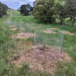
- Commenced revegetation of last remaining grazed area of Mt Sugarloaf reserve with a focus on biodiversity/restorative understorey planting.


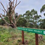
- Hollows for Habitat project now includes targeted wounding of trees of suitable size.


- Major revision of Emergency Access Plan in consultation with relevant emergency services.
- ‘Ngatanwarr’ First Nations information signs installed as part of ‘Indigenous Culture, Indigenous Landscape’ project. (Link and photos needed).
-
2022
2022 - Managing the Reserve
- Committee commences Management Plan review.
- Management Committee receive another successful grant application from CCMA. This is approximately our 15th grant from the CCMA.
-
2021
2021 - Managing the Reserve
- NAIDOC Week celebrations continue to be held annually, which is funded through CCMA grant.
- FoML still very active on the Reserves with a variety of activities including planting, weeding and general maintenance at The Volcanic Plains Wildflower Garden and other Reserve locations.
-
2020
2020 - Managing the Reserve
- 25th community Plant Propagation Workshop conducted by Friends of Mt Leura.

- Creation and printing of wildlife brochure: ‘Mammals, Amphibians and Reptiles of Mt Leura & Mt Sugarloaf Reserves’. Copies available from brochure boxes onsite and from Camperdown visitor information centre and available by clicking here.

- Creation and printing of wildlife brochure: ‘Mammals, Amphibians and Reptiles of Mt Leura & Mt Sugarloaf Reserves’. Copies available from brochure boxes onsite and from Camperdown visitor information centre and available by clicking here.
- 25th community Plant Propagation Workshop conducted by Friends of Mt Leura.
-
2019
2019 - Managing the Reserve
- Extensive review of current 2013-2018 Management Plan completed by the Management Committee. Amendments to extend Management Plan for additional 5 years (to 2024) approved by Council. Read Review.
- Major upgrade to ‘Walking trails of Mt Leura & Mt Sugarloaf Reserves’ brochure. Copies available from brochure boxes onsite and from Camperdown visitor information centre. Walking Trails Brochure.

- Started small scale plantings of small bird friendly understorey.
-
2018
2018 - Managing the Reserve
- Inaugural ‘4 Peaks Challenge’ conducted inviting interested community participants to summit Mt Leura, Mt Sugarloaf, Mt Elephant and Mt Noorat on the one day. The event is organised by FoML. Click here for map.
- Creation and printing of ‘Volcanic Banksia’ brochure. Copies available from brochure boxes onsite and from Camperdown visitor information centre.
Volcanic Banksia Brochure
- Solar panels, lighting and gas heater installed at the VEC. Paid for by FoML.
- The last major removal of the multiple cypress and pines from the Reserves (at Mt Sugarloaf quarry). Pine and cypress removal was commenced in 1995 by the Management Committee.

-
2017
2017 - Managing the Reserve
- Commence ‘Hollows Project’ manually creating habitat to accelerate restoration of wildlife on the Reserves. This project is funded by consecutive CCMA grants.

- Management Committee makes written presentation to Councillors to provide a detailed coverage the 20 plus years of the Mt Leura/Sugarloaf project. Click here to read the document.
- Commence conducting annual ceremonies and activities celebrating NAIDOC Week as part of the Indigenous Culture, Indigenous Landscapes Project.

- Commence ‘Hollows Project’ manually creating habitat to accelerate restoration of wildlife on the Reserves. This project is funded by consecutive CCMA grants.
-
2016
2016 - Managing the Reserve
- Commence process of identifying and developing nature play and outdoor educational resources. In 2018 regulations are deemed too difficult for Management Committee to maintain the nature play facility.
- Fauna monitoring across the two reserves undertaken. Management Committee engages the support of the Geelong Field Naturalists Club for this task in 2016, 2017 and 2019.
- Work on Volcanology Trail research and signage commences by local Federation University geology student. Management Committee continues the two year process of creating 7 themed signs. Signage completed and finally installed June 2018.


-
2011 - 2015
2011 - 2015
- 2015 – Banksia Trail established.


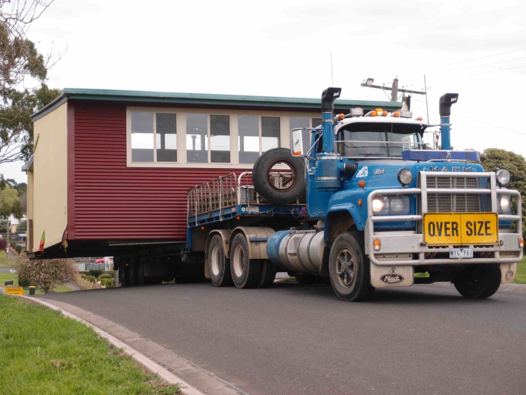
- 2014 – Volcanic Education Centre (VEC) established on site. The disused portable classroom building was gifted to the Management Committee by Camperdown College. It was officially opened during the Community ‘Come and Explore’ day on 13th September 2015 after lots of volunteer work to get it ready.


- 2014 – Banksia marginata (Silver Banksia) seed orchard planting commenced in area below Mt Leura summit lookout. Assisted by ‘Friends of the Forgotten Woodlands’ group. The seed orchard aims to help prevent the demise of this iconic Victorian Volcanic Plains tree form of Silver Banksia.
- 2013 – Second Reserve Management Plan (2013-18) adopted for implementation after extensive community consultation;
Click here to read the 2013-2018 management plan.
Here’s a general outline of objectives:
- Objective One: Enhance the Visitor Experience
- Objective Two: Protect and Enhance Environmental and Landscape Values
- Objective Three: Develop Promotional and Educational Opportunities
- Objective Four: Support Long Term Viability of the Reserves
- Objective Five: Mitigate Risk to Users and Surrounding Residents.
- 2013 – Major revision of ‘Volcanic Edge’ booklet reprinted – copies available from the Camperdown visitor information centre. Pull-up banners and posters are also created.

- 2012 – Management Committee engage services of a Melbourne ecologist to undertake a major bat survey. Results were unexpectedly very exciting with 8 of the possible 10 bat species present in South West Victoria identified on the Reserves. Read Bat Report.

- 2012 – Another successful Volunteer Community Planting Day (September).

- 2011 –
- 20 Year Anniversary celebration held to mark commencement of the project. Present and past Committee members, supporters, officials and the broader community invited.
- Reserves Walking Trail brochure has major upgrade and becomes colour.
- Governor of Victoria (Professor David de Kretser AC) visits Mt Leura.
- Major upgrade to boundary fencing.
- 2015 – Banksia Trail established.
-
2005 - 2010
2005 - 2010 Managing the Reserve
- 2010 –
- Mt Leura website undergoes first of ongoing major upgrades.
- Gained ‘Land for Wildlife’ status from Department of Sustainability and Environment.
- Geo-caching sites developed.
- Crater Shelter and information displays installed.


- 2009 – Friends of Mount Leura thrives – all ages, cultures, families, retirees combine on projects to develop and protect the Reserve for future generations.
- 2008 – Friends of Mt Leura, in partnership with the Management Committee, commence an annual Calendar of Events. Since 2008 these annual events have always included two community indigenous plant propagation workshops held every February and April growing mainly wildflowers and grasses from seed for the Volcanic Plains Wildflower Garden.

- 2007 – Community annual tree planting takes place in crater area and north face of Mt Sugarloaf.
- 2005 – Volcanic Plains Wildflower Garden commences at the lower car park area. A brochure about the display garden is available at the tourist information centre. Indigenous Flora Brochure.

- 2005 – National Trust provides funds for the re-fencing of Mt Sugarloaf quarry area to exclude stock and people.
- 2010 –
-
2000 - 2004
2000 - 2004 Managing the Reserve
- 2003 –
- 7 information signs designed by Management Committee installed in the Information shelter.
- Project gains momentum; seedlings nurtured, planting days, bird watching days, excursions, talks and walks.
- Mt Leura website created by a Camperdown College student.
- First edition of our booklet ‘Volcanic Edge’ is produced after a significant volunteer contribution.
- Annual September community tree planting day continues to engage local and regional people. The Camperdown College Environment Group annual ‘Environment Week’ tree plantings on Mt Leura and Mt Sugarloaf help with this process.
- Stone wall entrance to the lower information shelter constructed to reflect the volcanic nature of the area and tribute the work of Anglo-Celtic stonewallers who built kilometres of similar walls acros the volcanic plains.
- 2002 –
- Information shelter at the lower car park area, was constructed with timber from Cyprus trees milled onsite.
- 2001 –
- Indigenous tree planting program continues with all seedlings still produced in the Camperdown College nursery by students and staff as well as the Camperdown Lakes and Craters Environment Group.
- Project Officer (part-time) appointed by the Management Committee to assist with implementation of the Management Plan. They co-ordinated many groups including the following; Conservation Volunteers Australia teams, International Students Volunteers teams and Camperdown College students. Project Officer and volunteer groups will continue to assist with construction and installation of facilities such as steps, seats, shelters, signage and tree plantings.
- 2000/01 –
- Management Committee receives first successful grant application being a Natural Heritage Trust grant of $29,700 for the ‘Protection of threatened Allocasuarina and grassland communities on Mt Leura and Mt Sugarloaf’. The first of many successful environment grant applications sought by the Committee through the Corangamite Catchment Management Authority, as well as other organisations.
- 2000 –
- Mount Sugarloaf Reserve leased from The National Trust by The Corangamite Shire, so that revegetation could occur. Previously there were still cattle being grazed by the original landowner who was leasing the land.
- Friends of Mount Leura established. Community involvement grows.
- Olympic Landcare Planting undertaken around the lower shelter area.
- 2003 –
-
1995 - 1999
1995 - 1999 Managing the Reserve
- 1998 – Rotary Shelter and picnic area at Mt Leura summit constructed to commemorate 50 years of Camperdown Rotary.
- 1997 – The Management Plan adopted by the Corangamite Shire Council after an amendment to ensure important view lines of the volcanic landscape would be maintained.
- 1997 – First of the Annual Community Planting Day organised by the Management Committee, with approximately 200 volunteers in attendance.
- 1995 –
- The Panorama Trail created for people to enjoy a circuit walk from the summit car park through the two reserves.
- The first 30 of hundreds of pines and cypress to be removed from the Mt Leura and the Mt Sugarloaf Reserves. This is to be a slow and expensive process.
- Committee receives the first of ongoing annual budget allocations from Corangamite Shire Council for the implementation of the Management Plan.
- The first plantings in the inside of crater done by Camperdown College and Lakes and Craters Environment Group. Students have been involved ever since, as have many other thousands of volunteers; including visiting overseas groups.
- The Mount Leura Reserve title is passed from the Town of Camperdown on to The Corangamite Shire after amalgamation.
-
1990 - 1994
1990 - 1994 Managing the Reserve
- 1994 –
- The Mount Leura and Mount Sugarloaf Landscape Master Plan, Management Plan and Implementation Plan completed, jointly funded by the National Trust and the Town of Camperdown.

You can read initial Mt Leura and Mt Sugarloaf Landscape Master Plan and Management Plan revised 1998 by clicking this link.- The Mt Leura and Mt Sugarloaf Development Committee supersedes the Advisory Committee. This Special Committee of Council includes seven members -six very enthusiastic community volunteers and a representative from Council, and a part-time project manager employed to manage the reserves.
- The Camperdown College Community Nursery is developed jointly by Camperdown College, the Lakes and Craters Environment Group and Town of Camperdown. Its purpose is to provide necessary trees and shrubs for the Mt Leura Project.
- The Mount Leura and Mount Sugarloaf Landscape Master Plan, Management Plan and Implementation Plan completed, jointly funded by the National Trust and the Town of Camperdown.
- 1991 –
- Camperdown College enlisted by Town of Camperdown to create a ‘management plan’ for Mt Leura Reserve as part of a Year 12 class curriculum. After 6 months it is clear this task is too large for a school project.
- The Mount Leura and Mount Sugarloaf Advisory Committee of the Town of Camperdown was formed to develop an appropriate Management Plan. Thompson and Hay & Associates were appointed as the consultants in 1992.
- 1994 –
-
1966 - 1972
1966 -1972 Conservation Battle - Direct Action
- In 1966 scoria quarrying began on the western side of Mt Sugarloaf.
- About 20 residents from Camperdown sat in front of a bulldozer on the summit of Mt Sugarloaf.
- In 1970 Mount Sugarloaf & environs (38.8 hectares or 96 acres) was purchased by the National Trust (Victoria), and funds from a public appeal, this led to the creation of The Mt Sugarloaf Reserve.
- This sale followed a significant conservation battle to protect Mount Sugarloaf from further scoria quarrying.
- This conservation battle was possibly the first example of a community taking direct action to save a natural feature in Australia.
- In the early 70’s The Mt Sugarloaf Preservation Committee of the National Trust was formed. Pines and non indigenous natives were planted to screen the quarry.
-
1953 - 1963
1953 - 1963
- 1953 – The Mount Leura Reserve title passed on from the Shire of Hampden to the Town of Camperdown Council.
- 1963 – The road to the Mount Leura summit was sealed.
-
1920 - 1930
1920 - 1930
- Cypress and Pine planted on Mount Leura as part of a Returned Soldier’s Employment Scheme.
- Road to Mt Leura summit completed in 1935 (not sealed until 1963).
-
1899
Mt Leura Reserve Established
- There was a land swap with the Manifold Brothers and the Shire of Hampden which set aside public land that then created the Mt Leura Reserve (11.3 hectares or 28 acres).
-
1879
1879 Observations
- Recollection recorded in the Camperdown Chronicle reported that, 55 years earlier (1879), kangaroos were plentiful at Mount Leura.
- Native cats (quolls) were reported as being in plague proportions in the nineteenth century.
- Wombats were also present around the scoria cones.
-
1865
1865 Land Act
- The Land Act was passed, opening up all land between Geelong and the South Australian border to a ballot.
- The area around the Mounts was leased for farming, and heavy clearing followed.
- Within 50 years of European arrival the Mounts had been cleared of timber.
-
1858
1858 Paintings
- Von Geurard paints Mounts Leura and Sugarloaf from the Purrumbete Homestead.
- Austrian-born landscape painter Eugene Von Guerard worked in Australia between 1852-1882.
- His paintings, such as that of Mounts Leura and Sugarloaf are invaluable today in reconstructing the landscape as it was before settlement.
-
1851
1851 Surveyed
- The town of Camperdown was surveyed at the base of Mount Leura.
-
1839
1839 Early European Arrival
- The Manifold brothers, coming from Bateford near Geelong, drove their sheep into the area and settled on the banks of Lake Purrumbete. They took up an area of 80,000 acres including Mount Leura and Mount Sugarloaf.
- Others were soon to follow, taking up the land for their cattle and sheep.
- In the same year, Henry Gibb built huts beside a small stream north of Mount Leura and the settlement of Timboon was born. This area is now referred to as ‘Old Timboon’.
- Camperdown History – Camperdown Historical Society Website
- Cultural Heritage
-
DJARGURD WURRUNG
DJARGURD WURRUNG
- The Camperdown district was inhabited, for thousands of years, by the Leehura (Liwura) Gunditj Clan of the Djargurd Wurrong language groups who named Mount Sugarloaf “Tuunumbee Heear” or “moving moving woman”.
- Mount Leura and Mount Sugarloaf were used by the Leehura people as signalling towers and lookouts to observe movements of game and neighbouring peoples.
- The mounts were also important landmarks, guiding local people’s lifestyle.
-
EARLY HISTORY
GEOLOGY & EARLY HISTORY
- 10,000-40,000 years ago Mt Leura volcanic complex formed.
- In geological terms this is very recent activity.
- 35,000 years ago megafauna across the volcanic plains disappeared due to reason unknown.
- Geology – Read More
- The Changing Face of Mt Leura – PDF of presentation slides by Graham Arkinstall
